Pattern: Layered Impact Navigation
Layered Impact Navigation Pattern Definition: A structured interface approach that moves users from high-level impact to localized detail, and into process-level understanding.
What This Pattern Does
Moves users from orientation to explanation
Breaks complex work into navigable layers
Connects outcomes to underlying systems
Allows comparison across locations or units
What This Looks Like
From Map to Method (Community Solutions)
Shows how communities define, measure, and work toward outcomes over time.


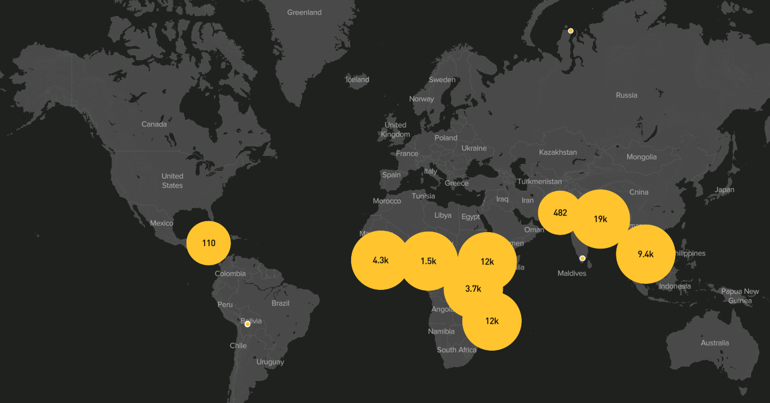
From Proof to Place (charity: water)
Shows how individual projects can be explored and verified through location-specific data, down to GPS coordinates, photos, and implementation details.
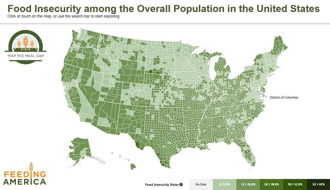
Early Stage Mapping Pattern: Feeding America, Map the Meal Gap
Shows how a national issue can be explored at the local level through layered data, but stops short of explaining how change happens.
Why Organizations Use It
Impact maps are evolving from showing where work happens to helping users understand how it works.
Organizations use this pattern when their work is distributed, complex, or systems-based. It allows them to move beyond surface-level metrics and show how outcomes are produced across locations and over time.
By structuring information in layers, the interface turns scale into something users can explore rather than just observe.
Application: Questions to Consider
Where does your current experience stop. At scale, or at explanation?
Can users move from a high-level view of impact into specific, localized examples?
Do you show the process behind your outcomes, or only the results?
Can users compare across locations, programs, or units
Where does added depth clarify the work, and where might it create friction?